
VOIE DIXIANE Canet d'Aude
A ROMAN ROAD PASSING THROUGH CANET
Today's village of Canet, 13km north-west from Narbonne, did not exist in Roman times, it was simply the highest point - 30m above sea-level - in the marshes of the flood-plain of the river Aude.
One day around 60BC the Roman centurian Rubrius brought his soldiers and their families to colonise the region. They travelled in carts, on horseback and on foot, north-west from Narbonne looking for higher ground. They crossed the river Aude and, reaching the first foothills of the Minervois mountains, they settled where is now the village of Roubia. The slope faced south - a perfect place! Today's village was named after Rubrius.
There was then much building and farming activity, which meant people had to go to and from Narbonne for supplies, and this usage established the road. The marshes were named "canna", Roman for reeds, which became, around 500AD, "Canet."
This road was called the Voie Dixiane by the local people, after the natural spring near the D11 toowards Serame. Much of this road still remains, having been kept in use by farmers and wine-makers, and you can walk along it. Take the D607 from Narbonne, and at the crossroads with the D69, turn left towards Nevian. Within a few metres you will see a farmers' track on the right - turn down here and you are on the Roman road.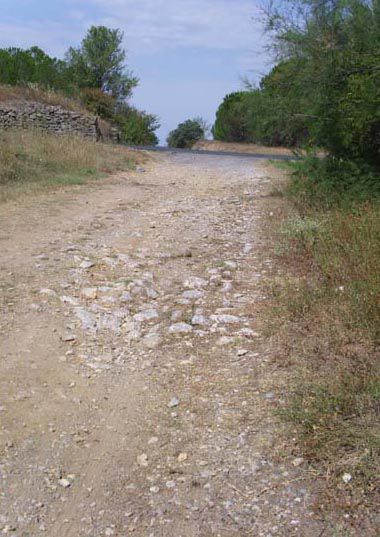
Pictures taken where the road crosses the modern Nevian/Marcorigan road. Remains - broken pottery and roof-tiles - from a Roman villa can be found on the right.
You can drive part of the way, passing to the south of Marcorignan, and then walk, until you reach the "Gué de l'homme" - "gué" means "ford". Here the Romans forded the river Orbieu. You will see another road there, on the left, coming from today's villages of Nevian and Montredon. (At Montredon excavations have been done and you can see the flagstones of the Roman road.)
At the ford, you cannot cross the river as dykes have been built to contain the river when it is in flood. But about 100 metres to the north, directly under the pylons overhead, the path from the domain called Cure Greniers reaches the Orbieu and you can cross the shallow river there. This place is maintained by the municipality of Raissac, the next village across the river.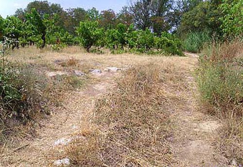
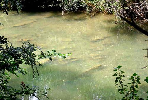
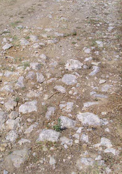
The road joins the road from Nevian (on the left) and continues to the gué, where you can see broken flagstones under the surface of the water.
Once across you will see signs saying "Voie Dixiane." The Association Via Aquitana gave this name to the road, after the "Source Dixiane", an ancient natural spring, which arises between Canet and Fontarêche, itself of Roman origin. The walk to Raissac and then to Canet is marked.
The Visigoths founded Canet. My mental picture shows them following the Voie Dixiane from Narbonne when they were reconnoitring the region around 414AD. To the left they saw the highest point in the marshes, a tiny rocky outcrop that you can still see in the courtyard of the château at Canet. There the Visigoths built a watchtower, which they fortified in the 6th century. They built a church for their soldiers, but it was always the Visigothic habit to make graveyards between 700 metres and 1 kilometre from their centres of population. They built the graveyard and its chapel on one side of the Roman road. Just behind today's cemetary.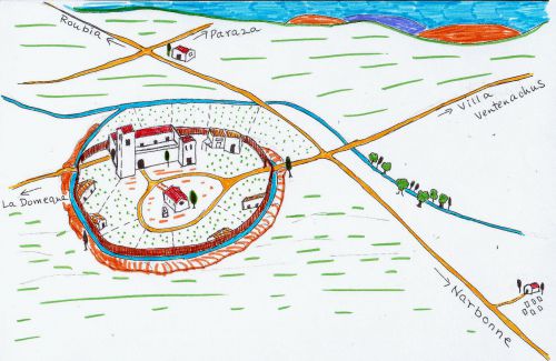
Val's impression of Canet in the time of the Visigoths (who came after the Romans.)
Canet itself
The road passed in front of the Mairie and crossed the Placette, where is the war memorial, and continued past the large house - 4, la Placette. It went across the marshes, where are now olive groves, and joined today's tarmaced road near the cistern.
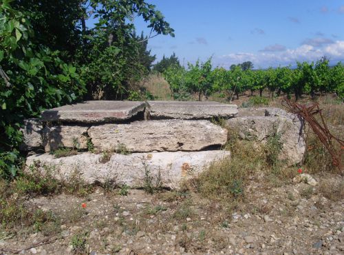
This cistern is really interesting. To the left is the trough for watering the animals, and the cisterne itself has been covered with blocks by the owner for safety's sake. If you look down it, you can see the change in construction about half way down. 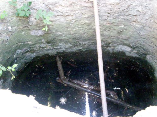
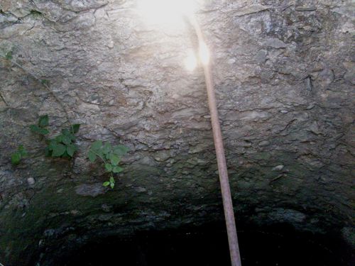
I believe it was originally Roman, the secondary construction being medieval. It was a vital source of water on the road from Canet to Roubia, except that Canet didn't exist then . . . I believe it was a roadside halt for travellers to water their horses and themselves, and buy wine in amphores.
Firstly, I have found many broken pieces of amphores and rooftiles in the field beside today's cistern. Secondly, if you look at the map, you will see there was probably another road or track coming from Cruscades, passing this cistern, and continuing to Paraza or Ventenac, itself founded by Ventenachus about the same time as Roubia. Many historians say that before Canet was founded, it was an important crossroads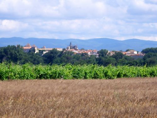
Paraza seen from the cistern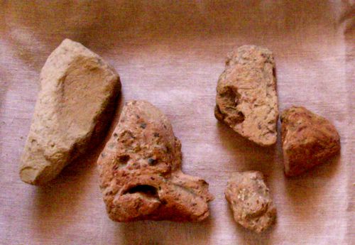
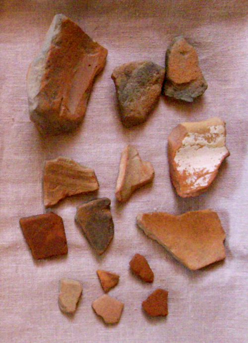
remains of rooftiles, pottery and amphores
The road continues to the "Pont de Vignes". The foundations are this bridge are Roman. Unfortunately, when the bridge was re-built by the Mairie around 1980, many Roman stones were lost. 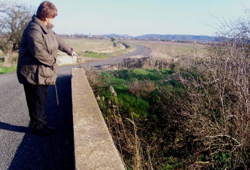
Above; you can see the village of Canet in the distance
below; the remains of the Roman foundations. 
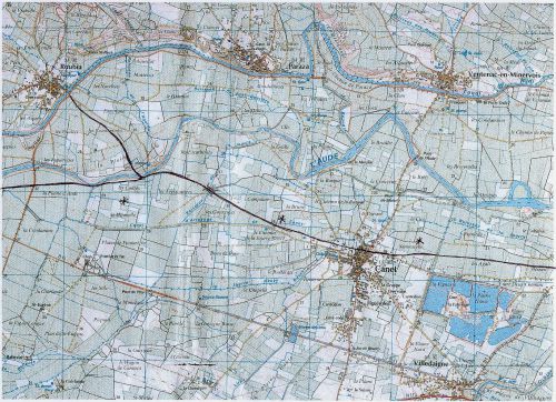
The route from Roubia to Canet and below, Canet to St Marcel 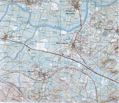
Then the road continues until it meets the river Aude. At this spot the river is narrow and shallow. Could the Romans have crossed here? It was no problem to Romans to cross rivers, they went across on rafts or on horseback.
Once again, proof; at this spot on finds oneself exactly 1 kilometre to the north of Fontarêche, and the field on the left is called Les Cadres. Found there were the remains of a small building - another halt for travellers? Those coming from both Canet and Fontarêche to Roubia would have met up there. Maybe there was even a ferry service?
The road also continued along the south bank of the river, through Montrabech to Sérame.
This Roman road now called Voie Dixiane remained in use for many years. The Black Prince from England travelled it when he came to take Narbonne - he and his army stayed at Sérame, courtesy of friends, and at Canet, courtesy of the Archbishop of Narbonne. And a local historian, Emile Dhombs, described how he walked to market in Narbonne with his father in 1928, along the old Roman road which forded the river Orbieu. I was moved by this as the Dhombs family used to live in the same house as I now do, in Canet.
Another Branch of the road passes through Nevian and Montredon
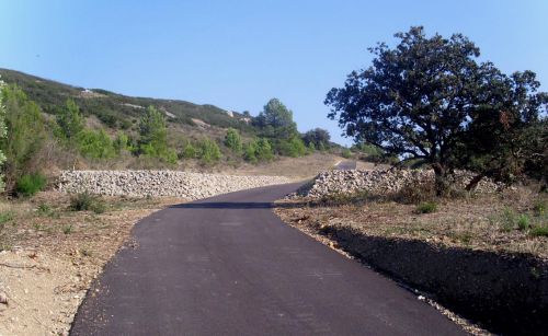
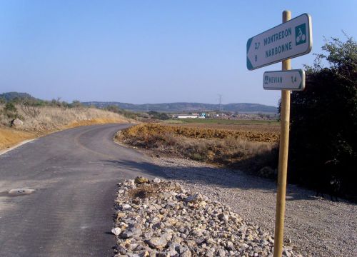
Look at the map and find Raissac on the left, and then the Gué de l'Homme. From there the Canet road joins what is now the D607, but from the Gué de l'Homme is another road to Nevian. This road too was Roman, and is still in use today, but tarmaced, so nothing Roman is visible.
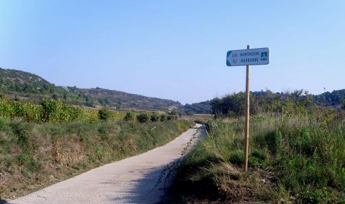
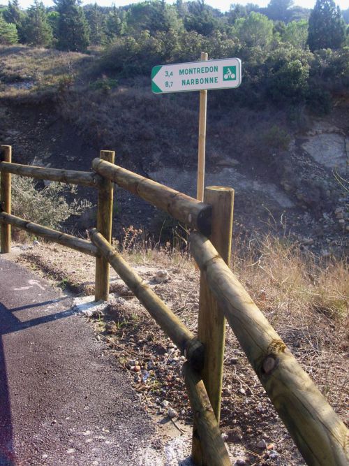
However, if you go to Nevian and find the Mairie, across the square you will find the Voie Dixiane signposted - you can trace it, going under the railway, on the map above. The Mairie of Nevian have concreted part of the road to make a walker's and cyclists' path to Montredon, and then Narbonne, where they have named the road "La Voie Littorale."
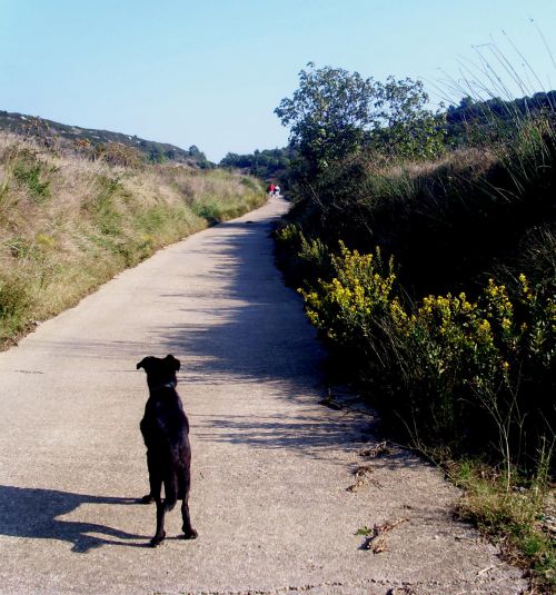
It is still shown on the map as a track or path; it remained in use as such ever since Roman days. We set off to walk along. At first there was no sign of anything remotely Roman . . . 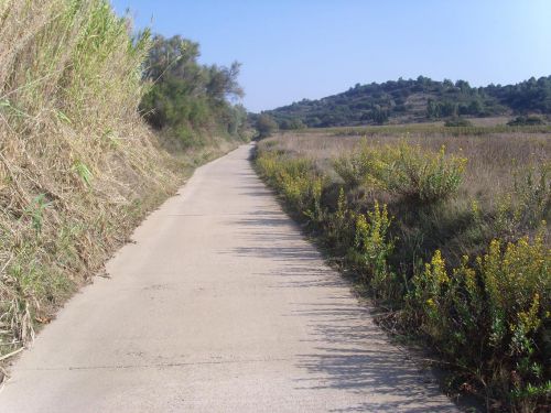
But wait! the concrete road turned to the left because the original Voie Dixiane/footpath was too narrow to surface, and there we found the remains of the original road. 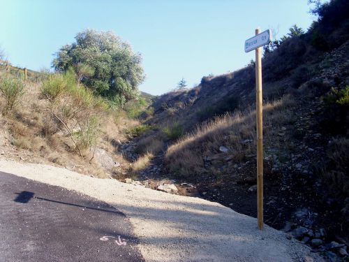
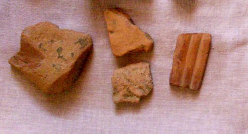
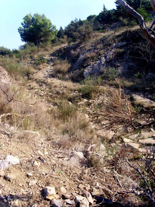
We stopped to look for Roman remains in the vines and found a piece of dolium and a tiny piece of sigillée pottery, very worn - and some fossils of this ancient land of Languedoc. 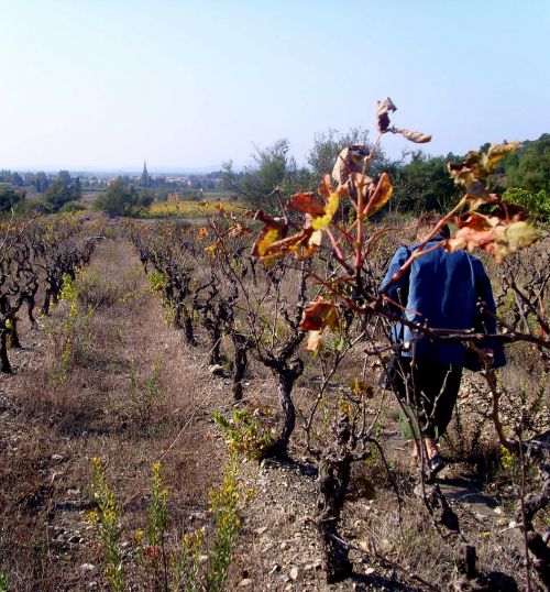
We continued and saw the remains of the Roman road on our right. 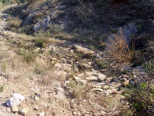
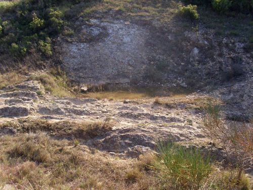
Can you see the marks of the chariots' wheels on the bedrock of the hill? Then we arrived at the "Col de Bucco Cers" - Bucco Cers is Occitan for the mouth of the north wind! We saw Montredon in the distance but looking back, the view of Nevian and then Canet - the water-tower was just visible - was magnificent. 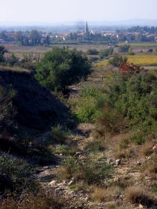
And to the right - had we discovered a Roman milestone beside the road? 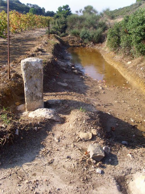
It was certainly well-positioned, but we weren't certain . . . 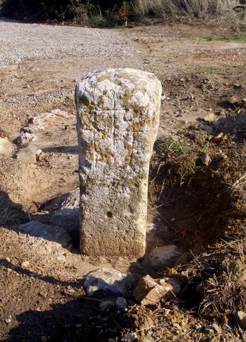
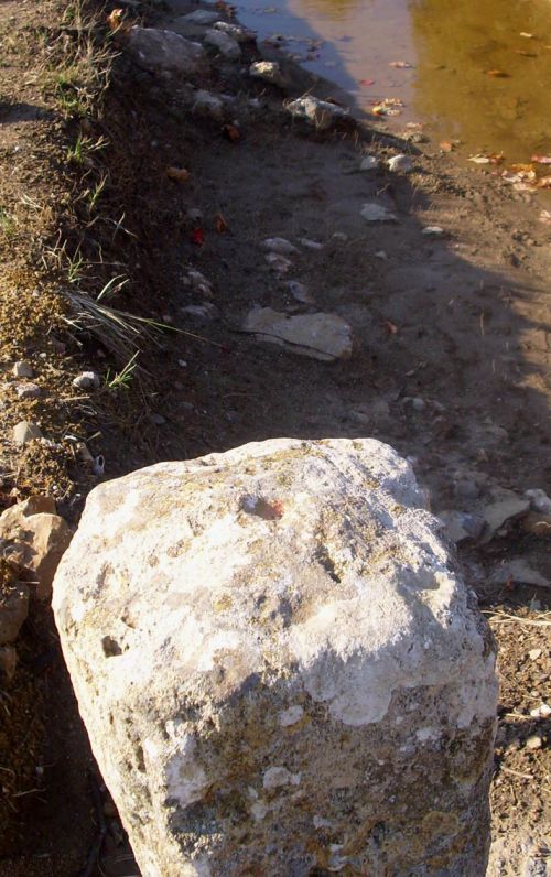
Then I found the marks of three crosses on the south-west face of the stone; it was a medieval stone to mark the highest point of the Col. On the top of it was a small hole, where once would have been a metal cross. This was our proof that this footpath/road had existed and been used from Roman times until today.
Inscrivez-vous au blog
Soyez prévenu par email des prochaines mises à jour
Rejoignez les 16 autres membres